
South Africa’s next cold front is rolling in and it’s bringing more than just a breeze.
The Western Cape is first in line, but by the end of the week, most of the country’s going to feel the chill.
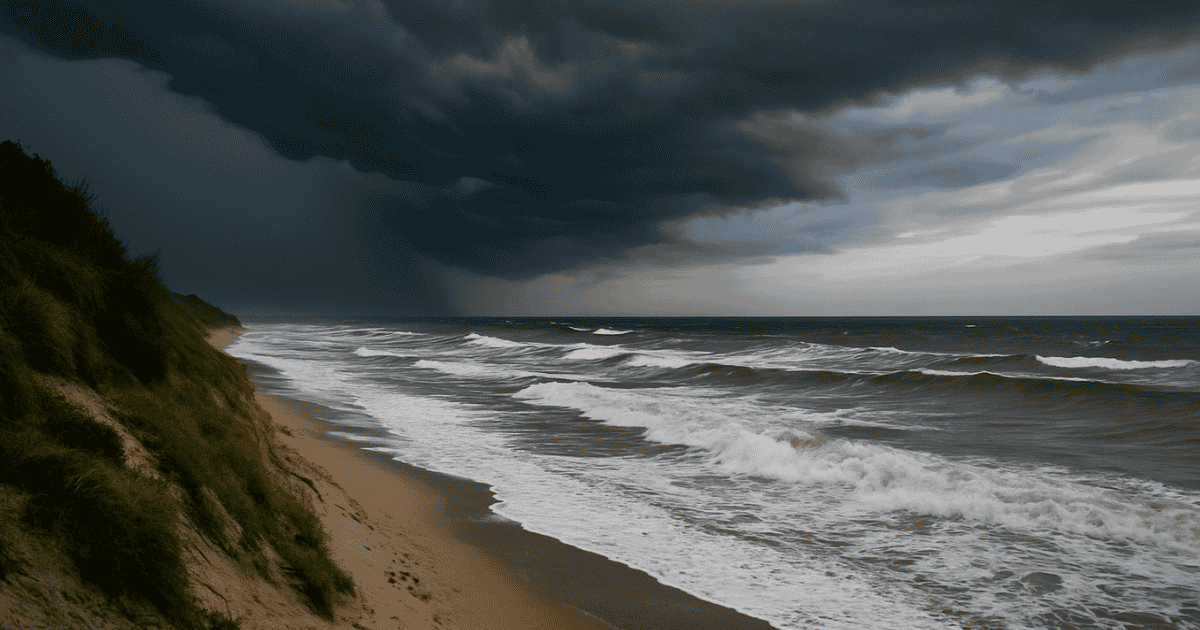
Cold front and coastal chaos
If you’ve been putting off swapping your summer sheets or dusting off that gas heater, now might be the time.
Here’s what to expect on Thursday and Friday, 17 and 18 July.
It’s starting in the Western Cape
According to the South African Weather Service (SAWS), the front will hit the Western Cape first, bringing rain and scattered thunder showers from Thursday.
A yellow level 2 warning for damaging waves is already in place for parts of the Western and Northern Cape coastlines.
Expect waves between 4.5 to 6 metres and winds gusting up to 60 km/h. That’s strong enough to knock small vessels off balance, or sweep the unwary off rocks.
Beach days? Maybe reschedule.
What the rest of SA can expect
Forecaster Tokelo Chiloane says the system is moving east. By Friday, it’ll be dragging cold, wet weather into Gauteng, KwaZulu-Natal, Mpumalanga, and the central interior.
The weather service has added that two areas north of the country are the only ones that will see warmer weather this week.
Musina and Upington are the exceptions; those lucky few can expect some warmth while the rest of us layer up.
Thursday and Friday outlook
SAWS maps show clear skies in the northeast but cold to cool conditions elsewhere.
Parts of the Eastern and Western Cape will see isolated or scattered showers, and Johannesburg, Kimberley, and Bloemfontein will sit under partly cloudy, chilly skies.
Rainfall probabilities are highest around George, Oudtshoorn, and coastal towns near the Garden Route.
Inland, it’s more about that biting wind.
If you’re in the south or on the coast, brace for disruptions. SAWS warns of possible delays at ports, hazardous conditions at sea, and localized issues for beachgoers.